

About the series:
Nordisk Korthandel - Gamle Landkort
This new range of antique maps are new releases of original maps from the Royal Librarys map collection.
The cards have been processed digitally and is printed on heavy canvas to achieve the beautiful look and the best quality.
Nyheder (Se Alle)
-
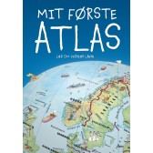
Mit første Atlas - lær om verdens lande
Dkr 199.95 -
 Dkr 149.95
 -
 Dkr 149.95
 -
 Dkr 149.95
 -
111 steder i Hamborg som du skal se
Dkr 249.00 -
Færdselskort Danmark 2024-2025
Dkr 149.95 -
 Dkr 149.95
 -
 Dkr 199.95
 -
111 steder i Trekantområdet som du skal se
Dkr 249.95 -
 Dkr 149.95