

About the series:
Hema Maps - State & City Maps
Hema
An Australian publisher. The maps mainly covers Australia, the whole country, the single states, regional areas, cities and New Zealand.
From the same publisher comes streetatlas to Australia and New Zealand.
Nyheder (Se Alle)
-
 Dkr 199.95
 -
 Dkr 149.95
 -
 Dkr 149.95
 -
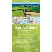
Færdselskort Danmark 2024-2025
Dkr 149.95 -
 Dkr 149.95
 -
 Dkr 149.95
 -
 Dkr 299.00
 -

111 steder i Trekantområdet som du skal se
Dkr 249.95 -
 Dkr 149.95
 -

111 steder i Hamborg som du skal se
Dkr 249.00