Kortoversigt
- 1:200 000
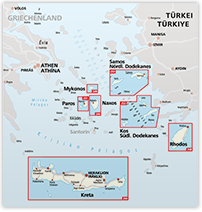
Example of mapcover
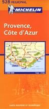
Example of selection of the map
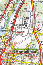
IGN Top 200
Maps from the state run French Institut Geographique National. Covers primarily France as roadatlas and in the mapseries Cartes Routieres (good for driving the car), Top 200 (good for biking) and Top 25 (good for hiking). Besides are published a range of different series of thematic maps to as differnet subjects as hisotrical routes, vinedistricts, gastronomical areas, biking - and sail routes, and nature parks. Outside France, they publish maps to European, Latinamerican, Asian and African countries, and especially to the former French colonies. On the maps are indicated latitude and longitude.
These maps in the scale 1:200.000 are very well suited for both cyclists and car drivers. They contain very detailed informations on the geografical appearance of the landscape, and cover the French road grid in a detail which no other publisher has yet been able to outdo.
Beside detailed markings of nature reserves and other sights like cathedrals, castles and other interesting buildings, the maps contain very detailed informations on the more unusual kinds of attractions like climbing sites and yachting harbours.
Pris: 115,-
Click on that map, you want to buy.
Brug musen til at navigere rundt på kortet. Når du flytter musen rundt, bevæger kortet sig med.
Klik når musen er over det kort du ønsker at købe.
Hvis du har problemer med at finde det rigtige kort er du altid velkommen til at kontakte os på post@scanmaps.dk